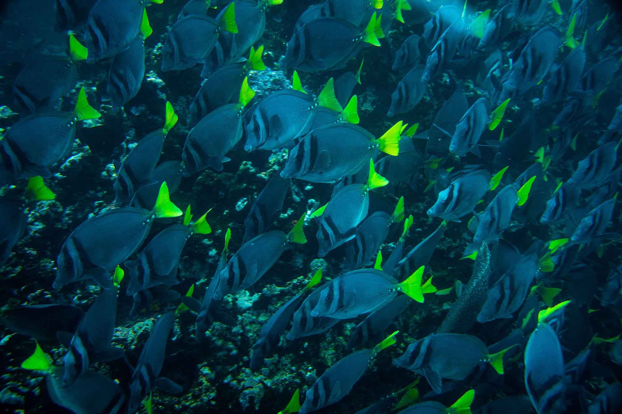
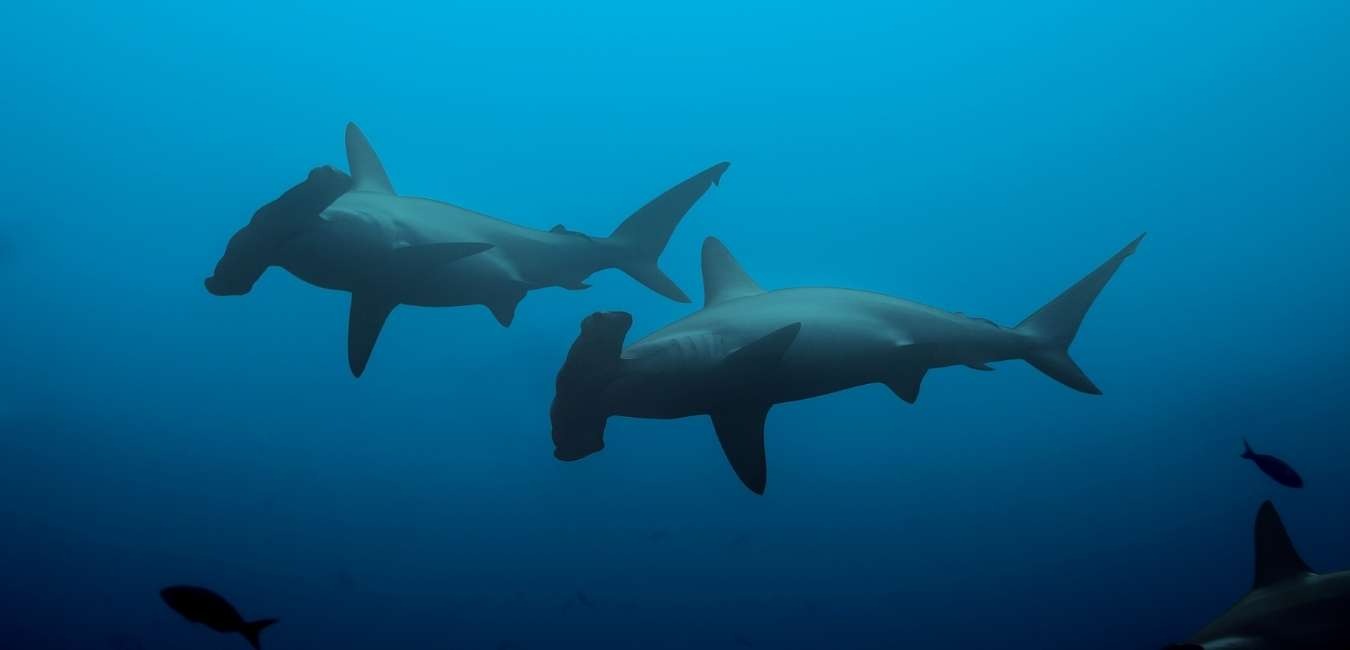
SOUTH 8 DAYS B


Day 1: Baltra Airport & North Seymour Island
Navigation and lunch service to Seymour Island North of Baltra

North Seymour Island

Dry landing. Nature walk in North Seymour It is approximately 2.25 km (1.25 mi) long and crosses the inland of the island. It also explores the rugged coast. The trail crosses the inland of the island and explores the rocky coast. It also passes Blue-Footed Boobie colonies. Magnificent Frigatebird is a large, black bird that has a wide wingspan and has a hooked beak. It is fast and excellent at vision. The large, red pouch at the neck of Frigatebirds is a signature feature. Boobies have a fascinating relationship with Frigates. The nesting area of North Seymour Bluefooted Boobies and Magnificent Frigatebirds is the same.

Guide briefing. Welcome cocktail. Navigation to San Cristobal Island and dinner service
Day 2: San Cristobal Island: Lobos Island, Kicker Rock & Witch Hill

Breakfast service. Dry landing. Nature walks and more wildlife watching Deep-water snorkeling.

Lobos Island

Lobos Island is known for its fur sea lions population and sea lions. There will be nesting areas for the great Frigatebird as well as a few blue-footed boobies. The breeding center will explain, in simple terms, the natural phenomena that created Galapagos Islands. This is the geology, as well as the natural processes that led to these amazing islands.

Witch Hill

Lunch service and navigation to Cerro Brujo Panga boat exploration rides. Wet landing. Nature walks. Deep-water snorkeling Cerro Brujo was one of Charles Darwin's first stops. It is a stunning white sand beach with brown pelicans, blue-footed boobies and sea lions. Cerro Brujo, an onshore version nearby Kicker Rock is a striking, eroded tuff con.
Kicker Rock is not a landing site. These rocks, also known as Leon Dormido, are found off the coast from San Cristobal. This channel is formed by two vertical rocks that rise 500 feet above the ocean. The natural monument is a popular spot for cruises because of the numerous Tropicbirds Frigates and Boobies in the air. The almost crystal clear waters beneath the sea offer an amazing display of colorful tropical fishes and invertebrates.

Guide briefing. Navigation to Espanola Island and dinner service
Day 3: Española Island: Gardner Bay & Suarez Point
Breakfast service. Deep-water snorkeling. Panga boat exploration rides to Gardner Bay. Dry landing. Osborn Islet, Gardner Islet. Nature walk. Swimming.

Gardner Bay

Suarez Point is 45 minutes away by boat from Gardner Bay. The beach is white sand and the colony of sea-lions can be found here. There are many options for scuba diving and swimming here. You will find both resident and migrant wildlife, including colorful Marine Iguanas and Espanola Lava Lizards. Also, you'll find Swallow Tailed Gulls and Blue Footed Boobies, Galapagos Hawks and a variety of Finch. You can snorkel at Osborn Islet and take a panga ride on Gardner Islet.

Suarez Point

Lunch service. Visit to Suarez Point. Dry landing. Nature walks Suarez Point is located at the western tip Espanola. It offers spectacular wildlife viewing, including Sea Lions and Sea Birds as well as the largest Marine Iguanas in the Galapagos. This is one the most beautiful places in the Galapagos. It is home to a wide range of wildlife. There are numerous Sea Lions, large, colorful Lava Lizards, and Marine Iguanas along the beach. Follow the trail to the edge of the cliff and you will see Masked Boobies nesting in the rock formations. Just a short distance from the trail is a Blue-Footed Boobie nesting area.

Guide briefing. Navigation to Floreana Island and dinner service
Day 4: Floreana Island: Cormorant Point, Champion Islet & Post Office Bay

Breakfast service. Visit Floreana Island: Cormorant Point and Champion Islet. Baroness Viewpoint. Wet landing. Nature walk. Possible activities: deep water snorkeling, kayaking, panga boat exploration rides.

Cormorant Point

Cormorant Point has two beaches. On the shore, you'll find a sandy beach with a green color. This is due to the olivine crystals that are silicates, magnesium, and iron. You will then follow the trail to the lagoon, where you can see Pink Flamingoes as well as other shorebirds making their home. You will see cracks in the mud at this lagoon. These cracks are not due to dryness, but are actually flamingo footpaths. You can also see Large-Billed Flycatchers and Small-Ground Finches. Continue the walk to another beach, known as "Flour Beach", which is made up of fine white sand particles. You can see ghost crabs and rays swimming in the water. You can even snorkel or go swimming if you have the time and weather permits. Afternoon: Lunch service. Panga boat ride to Post Office Bay*. Wet landing. Nature walk** Snorkeling at the beach
The Post Office Barrel was established by British whalers in 1793 to send letters from England. The tradition has been carried on over the years and visitors can still drop by to pick up letters without stamps to be transported to distant destinations. This site is one of few that can be visited solely for its human history. The wooden post barrel was established by Captain James Colnett, a whaling captain. It was built in 1793. Whaling was a large industry at the time, so ships would often be gone for two years. These ships often stopped at the Galapagos Islands. After rounding the cape, outbound ships would drop off their letters and return home to mail them. Over the years, thousands of ships stopped at Post Office Bay to receive and send mail. Many people have left a memorial sign with driftwood or other materials to remember their trip. Graffiti is only allowed in this area of the Galapagos.

Bay Post Office

Post Office Bay is where you'll land. You will pass the sun-kissed sea lions as you approach. The guide will collect a few letters from the group at the post barrel. The letters are then taken home by the traveler to be mailed to the recipient. Visitors can also send their own letters. The remains of the Norwegian Fishing Village, a commercial fishing operation that was established in 1926 but abandoned several years later, are also available. A group of Norwegians came to the Philippines with hopes of riches and started a can-and-fishing business. Each person earned $900. They were forced to abandon their dreams by the Galapagos' harsh life and some misfortunes.
If the weather and time permit, you might be able to snorkel from the beach again.

Guide briefing. Navigation to Santa Cruz Island and dinner service

Day 5: Santa Cruz Island: Highlands, Rancho Primicias & Charles Darwin Station

Highlands & Rancho Primicias

Breakfast service. Visit Santa Cruz Highlands. Dry landing.

Santa Cruz's highlands are home to incredible areas of vegetation. Visit the private estate, "Las Primicias". This reserve is the best place to see the giant turtles of Santa Cruz Island. They can be viewed from close range.

Charles Darwin Station

Lunch service. Visit to Charles Darwin Scientific Station & Breeding Center Dry landing

Charles Darwin Station is the main attraction in Puerto Ayora. This is a great way to learn about the islands and their formation. Learn about the raising of the Galapagos turtles and meet Jorge, the famous single turtle. On weekends, the Scientific Station hosts many visitors to its beach.

Guide briefing. Navigation to Floreana Island and dinner service

Day 6: South Plaza Island & Santa Fe Island
Breakfast service. Dry landing. Visit South Plaza. Nature walk. Deep-water snorkeling

South Plaza Island

South Plaza's dry landing is the first step. The island is surrounded by a rocky trail that circles it. It displays a combination of coastal and dry vegetation zones. South Plaza is home to one of the most extensive populations of Land Iguanas anywhere in the Galapagos. Once you land, the iguanas are everywhere. These iguanas are larger than the average yellow-brown land iguana and eat the fruits and pads of the prickly pears cactus. South Plaza also houses Marine Iguanas that live along the coast, and Hybrid Iguanas. Their fathers are Marine Iguanas while their mothers are Land Iguanas. The walk continues along the sea cliffs and you will often see Swallow-tailed Gulls as well as Frigatebirds. Red-billed Tropicbirds. Brown Pelicans. Blue-Footed. Masked Boobies can also be seen. A colony of Bachelor Sea Lions is visible just below the shore.

Santa Fe Island

Lunch service. Navigation to Santa Fe Wet landing. Nature walks. Deep-water snorkeling
Santa Fe Island is home of one of the most stunning coves in the Galapagos. It is located in the southeast part of Galapagos and is 2 1/2 hours away from Santa Cruz, 3 hours from San Cristobal. Santa Fe was created by an uplift, rather than a volcano. This gives the island a flat surface instead of the conical shape that is typical for other islands. A panga boat ride through the beautiful turquoise lagoon is the first step to Santa Fe. Once you arrive at the Galapagos, you will be introduced to one of the many colonies of sea lions. While bulls vie for beach master, cows enjoy the sun. It's quite an amazing sight! You can easily approach Galapagos Hawks by following the loop trail that runs around the island. Santa Fe is home of the endemic Land Iguanas. These iguanas, which are large and beige-to-coconut brown in color, resemble small dinosaurs. The cove below is stunning when you reach the summit.

Guide briefing. Navigation to San Cristobal and dinner service
Day 7: Santiago Island, Bartolome Island & Chinese Hat Islet

Breakfast service. Deep-water snorkeling. Bartolome. Dry landing Nature walks

Bartolome Island

This is the most photographed and visited island in Galapagos. It has very few plants. It is home to an extinct volcano as well as a variety red, orange and green volcanic formations. Pinnacle rock, also known as the Tuff Cone, is one of the most well-known features on the island. This large, black, partially eroded lava form was formed when magma from the volcano reached sea level. The seawaters cool the hot lava and cause an explosion. The fragments that exploded eventually fuse together to form a rock made of thin layers. Pinnacle Rock, Bartolome's most famous and photographed landmark in the islands. It was a prominent landmark that served as a target for US Airmen during WWII. The Pinnacle Rock is surrounded by twin beaches of half-moon shape. Visitors can swim with fish, Sea Lions, and Galapagos Penguins at the northern beach. You will also find stingrays and spotted eagle Rays as well as white-tipped sharks and black-tipped Sharks near the southern shore. This barren area is home to very little vegetation. The beach is surrounded by mangroves, and the tiny shrub Tiguilia thrives in the volcanic sands. The tiny, white Chamaesycae flowers and seeds provide food for the island’s finch. These plants can survive in harsh volcanic environments and are common in arid areas.

Santiago Island & Chinese Hat Islet

Lunch service. Santiago Island. Wet landing at Chinese Hat. * Nature walk Deep-water snorkeling
*Visit Chinese Hat, a small island located just southeast of Santiago. The island's shape is described by its name. It is worth the trip for those who visit the island. It is centrally located, but it is not the most visited site in the region. Chinese Hat has been restricted by the National Park Service. Only multi-day cruises of 14 or fewer passengers are allowed at this location. The landing site is located on a crescent-shaped, white sand beach that is home to Sea Lions as well as Sally Lightfoot Crabs. Sombrero Chino's trail explores the volcanic origin of this island, which is one of the most prominent in the region.
It is extremely fragile and can break apart when people walk on it. These breaks cause sharp outcroppings, so it is important to wear sturdy walking shoes. On the island, you will find patches of Pahoehoe Lava and cracked lava. Although the path doesn't take you up to the red rust sides that make up the Chinese Hat, but it does allow for spectacular views of the waves below. Snorkeling near Chinese Hat can cause a stir. White-tipped sharks, Galapagos Penguins, and Sea Lions all frequent this area.

Guide briefing. Farewell cocktail. Navigation to Santa Cruz Island and dinner service
Day 8: Mosquera Islet & Baltra Island
Visit Mosquera Islet*. Wet landing. Nature walk. Breakfast service. Check out at 8 AM and depart for the airport
The Mosquera Islet lies between the islands North Seymour and Baltra. It is home to a coral reef and great white sand beach. It measures in at 160 meters wide and 600 meters long. The lava rocks that make up the majority of the perimeter are evidence of the lava rising. However, the landing is only found on the southwest side. The island is home to one of the most numerous populations of sea lions. There are many species of shorebirds that can be seen on this island. There are occasional reports of Orcas (Orcinus Orca) eating sea lions at this location.

Included

  • Scheduled visits and activities with a professional bilingual guide
  • All meals on board, some snacks, purified water, tea and coffee
  • Accommodation in a standard cabin with private bathroom and air conditioning
  • Snorkeling equipment (mask, lenses, fins), sea-kayaks
  • Assistance at the Airport and 24/7 during the trip

Not Included

  • Air tickets to / from Galapagos from / to Quito, Guayaquil or combined route
  • Entrance to the Galapagos National Park US $ 100 p.p. (cash in the Islands)
  • Galapagos Control Card US $ 20 p.p. (at the airport before check-in)
  • Wet-suits rental on board (in cash)
  • Soft and alcoholic drinks on board; personal expenses, extras and tips guide and crew (cash)
  • Travel insurance with medical, cancellation and other unforeseen coverage
  • Other services in Continental Ecuador and not specified in the program